Raška
"Raška, the place where we were born" ... Nikola Pašić
Geographical location
The Raška Municipality is located in the southwestern part of Serbia at 43º18′ latitude and 20º32′ longitude, at the mouth of the Raška River in Ibar, in the central part of the Ibar Valley, on the western slopes of Kopaonik and the eastern slopes of Golija. It extends to 670 km², where about 25,000 inhabitants live. The city center is the town of Raška, and within the municipality there are two other town settlements: Baljevac and Jošanička Banja.
Relief
In the relief of the municipality of Raška, three morphological units are clearly expressed: the bottom of the basin, basin circumference and the mountain zone. The Raška region is distinctly mountainous, as 88% of the territory is above 500 m above sea level. In this area there is Kopaonik (Pančićev vrh, 2,017 m), as well as the Golija Mountain (Jankov kamen, 1,833 m). In the relief of the municipality of Raška the river valleys that go deep into the hilly areas of the mountainous branches of Kopaonik, Golija and Rogozna are especially distinguished.
How to reach Raška?
The best and shortest route from Belgrade to Raška (252 km) is the Ibar highway. From Raška one branch of the main road is separated to Novi Pazar (21 km) and further towards Montenegro, and the other branch to Kosovska Mitrovica (64 km).
Two regional roads from Raška lead to the Kopaonik tourist center: via Rudnica (28 km) and through Jošanička Banja (54 km). The largest winter tourist center of Kopaonik is 270 km south of Belgrade and 100 km from Kraljevo.
Jošanička Banja is 30 km away from Raška, 245 km from Belgrade and 74 km from Kraljevo.
Raška is 51 km away from Golija Nature Park.


Natural reserves
Walking tours
Excursion sites
Attractions
Churches and church property
Cultural and historical sights
Monasteries
Active vacation
Sport and recreation
Gastro offer
Cultural offer
Fun
Hotels
Apart Hotels
Resort
Lodging and hostels
Villas
Apartments and rooms
What to see
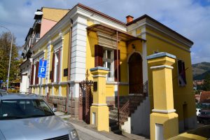
House of Kursulić
The building of the Center for Culture, Education and Information, within the framework of which is the city library, gallery and memorial room “Raška – War Capital of the Kingdom
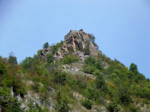
Medieval city Brvenik
The medieval town at the mouth of the river Brvenica in Ibar is located 5 km south of Baljevac, 8 km north of Raška, built on a dome hill at 599 m above sea level. Brvenik was a ty
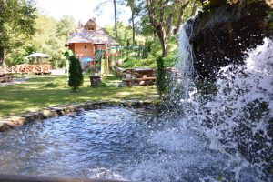
Excursion site “Očna Banja Gradac”
The excursion site is located in the immediate vicinity of the Gradac Monastery, in the former park of the Queen Helen of Anjou. This site is famous for the water spring good for e
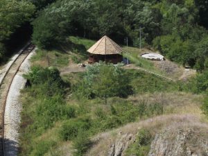
Excursion site “Izvorak”
In the immediate vicinity of the monastery of Stara Pavlica, 9 km north of Raška, there is a locality among people known as “Izvorak”. The site consists of two parts separated by a
Where to stay
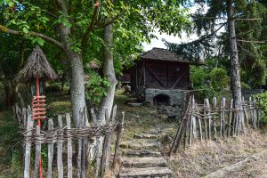
Сеоско туристичко домаћинство „Топлина душе“
Сеоско туристичко домаћинство „Топлина Душе“ налази се у селу Павлица и састоји се од породичне куће, мини зоо врта и етно музеја који чини једанаест објеката (брвнара) са различит
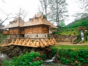
Apartments and rooms Gradačka Banja
Сеоско домаћинство Градачка бања се налази на обронцима планине Голије у селу Градац у непосредној близини манастира Градац, 20 км удаљено од Рашке. Састоји се од уређеног парка са

Motel-restaurant Jagnjilo
Tavern with lodging “Jagnjilo” is located on the main road Raška – Kraljevo, 1.2 km from the city center. It has 27 rooms (single, double and triple rooms, 9 rooms with Jacuzzi tub
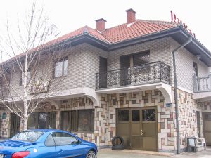
SUTZR Royal
SUTZR “Royal” is located at the crossroads of the main Belgrade-Raška-Podgorica-Skopje highways. It has luxuriously equipped three-bed apartments, double and single rooms. All apar
- 1
- 2

 2019
2019